





They are separate municipalities, but they face similar issues.
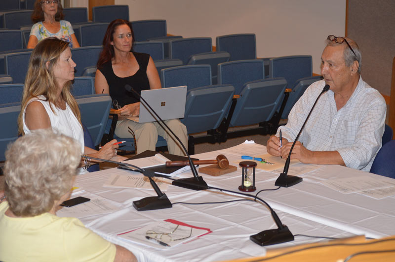
“Water doesn’t know a boundary line,” Lynn Burnett, city engineer for Bradenton Beach and Holmes Beach, said May 21 during a Coalition of Barrier Island Elected Officials meeting in Holmes Beach.
City representatives touched on several topics at the meeting, including sea level rise and a long-range transportation plan.
Five city officials participated, including Anna Maria Mayor Dan Murphy, Bradenton Beach Mayor John Chappie, Holmes Beach Mayor Judy Titsworth, Longboat Key Mayor George Spoll, Holmes Beach Commissioner Carol Soustek and Tom Harmer, Longboat Key town manager.
The meeting began with a presentation by Burnett on the Tampa Bay Regional Resiliency Coalition.
Burnett read some of the goals of the TBRRC, which stated the coalition “was formed to coordinate climate adaptation and mitigation activities across county lines” and to provide technical assistance and support to state and local agencies dealing with problems from climate change and sea level rise.
She said sea level tracking technology has improved, and data show the level is rising faster than initial projections.
“We need to do something sooner, rather than later,” she said. “There comes a tipping point, where if we wait we’ve waited too long.”
Burnett said working together as a region deemed one of the most vulnerable to sea level rise in the United States strengthens requests for federal grants.
“If we can pull together on a regional effort, then we have a much stronger voice,” she said.
Holmes Beach unanimously approved and signed the coalition memorandum of understanding May 14.
Manatee County also is a partner.
Chappie said Bradenton Beach has requested more information before agreeing to the joint effort.
Anna Maria also has not yet joined the coalition.
Burnett also spoke about a long-range transportation plan for the region, saying the topic ties in with the discussions on climate change and sea level rise.
“As we’re looking at our future transportation needs, keep in mind the resiliency piece of it as well,” she said.
Burnett said when considering alternative transportation, such as water taxis, people must think of supporting infrastructure.
Murphy said the coalition should address water taxis as public transportation.
He said for a water taxi to be successful, it must be affordable, adding that affordable transportation for service workers would help alleviate traffic congestion.
Spoll said connectivity, including parking, also is an issue.
Murphy suggested the coalition further discuss water taxis at the next BIEO meeting, and suggested an expert should speak on the matter.
Harmer said Longboat Key has a joint meeting June 13 with the city of Sarasota to discuss Sarasota’s plans for water taxis based on an ongoing feasibility study. He said he would report on the matter at the next BIEO meeting, set for 2 p.m. Tuesday, June 18, in the chambers at Longboat Key Town Hall, 501 Bay Isles Road.
“It’s a part of the overall picture and I think it’s a big part,” Soustek said of water taxis. “There’s a lot of research that’s been done, all we have to do is get everybody at the table.”
sea level tracking technology has improved, and data show the level is rising faster than initial projections.
Mayor Judy, Engineer Lynn , Anna Maria, Mayor Dan and the others would do well investigate the truthfulness of the sea level studies they are relying on. First on the list of places to go is the tide gauges. There’s a nice site on the net that has the historical data:
The Permanent Service for Mean Sea Level (PSMSL)
https://www.psmsl.org/data/obtaining/
The St. Petersburg tide gauge
https://www.psmsl.org/data/obtaining/stations/520.php
tells us that sea level is on track to rise 10 to 24 inches (linear & quadratic extrapolations) by 2100. That’s probably a lot less than the sea level tracking technology (satellites?) that are being relied on. The folks maintaining the satellite data at the CU Sea Level Research Group
http://sealevel.colorado.edu/
Have been steadily rewriting their historical data to increase the rate or show acceleration since 1993. Satellite data bears no resemblance to what the tide gauges show. Tide gauges provide the local information you need. The nearest PSMSL tide gauge is at the south end of the Albert Whitted Airport just across the bay. Why not pay the keepers of that tide gauge and its data a visit? See what they have to say. After all, it’s probably funded by the local taxes.
Steve Case – Milwaukee, WI